Navigating the sea is a profound experience, and to make it even more enriching, products like Navionics Plus and Platinum Plus come into play. While they may appear similar at first glance, their attributes distinguish them from each other.
So, let’s plunge into the ocean of knowledge and unravel the characteristics, pros, and cons of both these marine navigation systems.
A Brief Comparison Table
| Feature | Navionics Plus | Platinum Plus |
| Geographic Coverage | Broad | Broad with coastal pilot instructions |
| Mapping Features | Nautical Charts, SonarCharts™, Community Edits | Nautical Charts, SonarCharts™, Community Edits, Satellite overlay |
| Visuals and Views | Basic 2D views | 3D views, panoramic port photos, high-definition fishing detail |
| Relief Shading | No | Yes |
| Price | More affordable | Higher, due to advanced features |
Navionics Plus: A User’s Perspective
Navionics Plus is a marine charting software that is lauded for its detailed and accurate navigation charts. It’s loaded with more than 20,000 charts and bathymetric maps, covering both U.S. and Canadian coastal waters.
Navionics Plus

Navionics Plus integrates marine and lake content in one product. With its community edits feature, you have access to thousands of edits by users like yourself, keeping the maps continually updated.
Additionally, it offers a seamless chart presentation which proves crucial in navigation.
- Pros of Navionics Plus
Navionics Plus stands out for its broad and expansive coverage. With a subscription, you can download and update nautical charts and SonarCharts™ on your device.
Moreover, the dynamic tides and currents feature provides insightful information about water movement.
- Cons of Navionics Plus
On the downside, some users have found Navionics Plus to lack certain advanced features that competing products offer. Relief shading, a feature highly appreciated by users for enhancing the depth perception of sea floor and lake bottom structures, is notably absent in Navionics Plus.
Also Read: Differences Between Hail Recon And HailTrace.
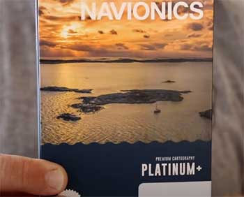
Platinum Plus: Pushing the Boundaries
Platinum Plus is the higher tier of Navionics cartography. It elevates marine navigation to a new level by offering enriched details and panoramic views.
- Key Features of Platinum Plus
The defining feature of Platinum Plus is its 3D view and satellite overlay combined with SonarCharts™. This dramatically enhances clarity and aids in understanding the marine environment.
Plus, the inclusion of a dynamic tide and current feature, similar to Navionics Plus, makes it a reliable choice.
- Pros of Platinum Plus
The USP of Platinum Plus is its inclusion of panoramic photos, 3D/2D views, and geo-referenced coast pilot. The relief shading feature is an additional advantage, enabling users to better visualize underwater topography.
It also includes the same charts as Navionics Plus but adds an extra dimension with its more advanced features.
- Cons of Platinum Plus
The only potential drawback of Platinum Plus is its higher cost. The enhanced features come at a price, making it a premium product in the marine navigation software market. Some users might find these extras unnecessary, depending on their specific navigational needs.
Key Differences Navionics Plus And Platinum Plus
At first glance, the distinction between Navionics Plus and Platinum Plus may seem blurry, but when you dive deeper, their differences emerge, each with its unique selling propositions and features.
Let’s dissect their variances in more detail.
- Geographic Coverage
Both Navionics Plus and Platinum Plus boast impressive geographic coverage, featuring an extensive range of coastal and inland water bodies.
However, their representation varies.
Navionics Plus primarily focuses on offering comprehensive 2D marine and lake charts.
In contrast, Platinum Plus enhances this coverage by integrating geo-referenced coastal pilot instructions, providing mariners with an extra layer of contextual information that isn’t available in Navionics Plus.
- Mapping Features
When it comes to mapping features, the differences are even more stark. Navionics Plus offers top-quality nautical charts, SonarCharts™, and community edits. The SonarCharts™ offer an excellent depiction of seabed profiles, while community edits allow users to contribute to the accuracy of charts.
Platinum Plus takes mapping features a notch higher. In addition to providing the features offered by Navionics Plus, it incorporates satellite overlay with SonarCharts™, offering a bird’s eye view of the surroundings.
Platinum Plus also introduces 3D views, aiding mariners in visualizing their marine environment like never before.
- Visuals and Views
Navionics Plus, while offering reliable and accurate charting, doesn’t provide advanced visual features. It sticks to the basics, ensuring users get a clear, straightforward view of their navigational charts.
On the other hand, Platinum Plus introduces enhanced visuals. It boasts 3D views, offering a unique perspective of the marine environment, thereby enhancing spatial awareness.
Furthermore, Platinum Plus also offers panoramic port photos and high-definition fishing details, which can be beneficial for recreational sailors and fishermen.
- Relief Shading
An important difference between Navionics Plus and Platinum Plus lies in their relief shading feature. Relief shading enhances the depth perception of sea floor and lake bottom structures, which can prove crucial during navigation.
Unfortunately, Navionics Plus lacks this feature. Platinum Plus, however, incorporates relief shading, providing a vivid and detailed depiction of the underwater landscape. This feature, combined with its 3D capabilities, enables a superior, comprehensive understanding of the sea floor.
- Price
Last but not least, price plays a significant role in distinguishing between Navionics Plus and Platinum Plus. Navionics Plus is more affordable, making it a suitable choice for those who need reliable navigation but may not require advanced features.
In contrast, Platinum Plus, with its range of advanced features, is priced higher. The added cost may be worthwhile for professionals or marine enthusiasts who demand an elevated level of detail and context in their navigational aids.
Also Read: Comparison of Furuno And Garmin Fish Finders.
Frequently Asked Questions (FAQ)
While both products offer nautical charts, SonarCharts™, and dynamic tide and current features, Platinum Plus provides additional value. It includes panoramic photos, 3D/2D views, geo-referenced coast pilots, and relief shading, which are not present in Navionics Plus.
Navionics Platinum Plus is a premium marine navigation software that offers advanced features. These include panoramic photos, 3D/2D views, relief shading, and a geo-referenced coast pilot.
Navionics Plus provides detailed nautical charts and SonarCharts™, along with dynamic tides and current information. Its main aim is to facilitate marine navigation by offering a seamless and accurate charting system.
No, Navionics Plus does not feature relief shading. This feature is available in the premium Platinum Plus product.
Wrapping Up
In conclusion, while Navionics Plus and Platinum Plus are both robust and reliable navigational aids, your choice depends on your specific needs. The former is an affordable and comprehensive tool with broad coverage, while the latter is a premium product offering an enhanced visual and navigational experience.
Be it cruising, fishing, sailing, diving or any marine activity, these systems guarantee a safer and more enjoyable experience.